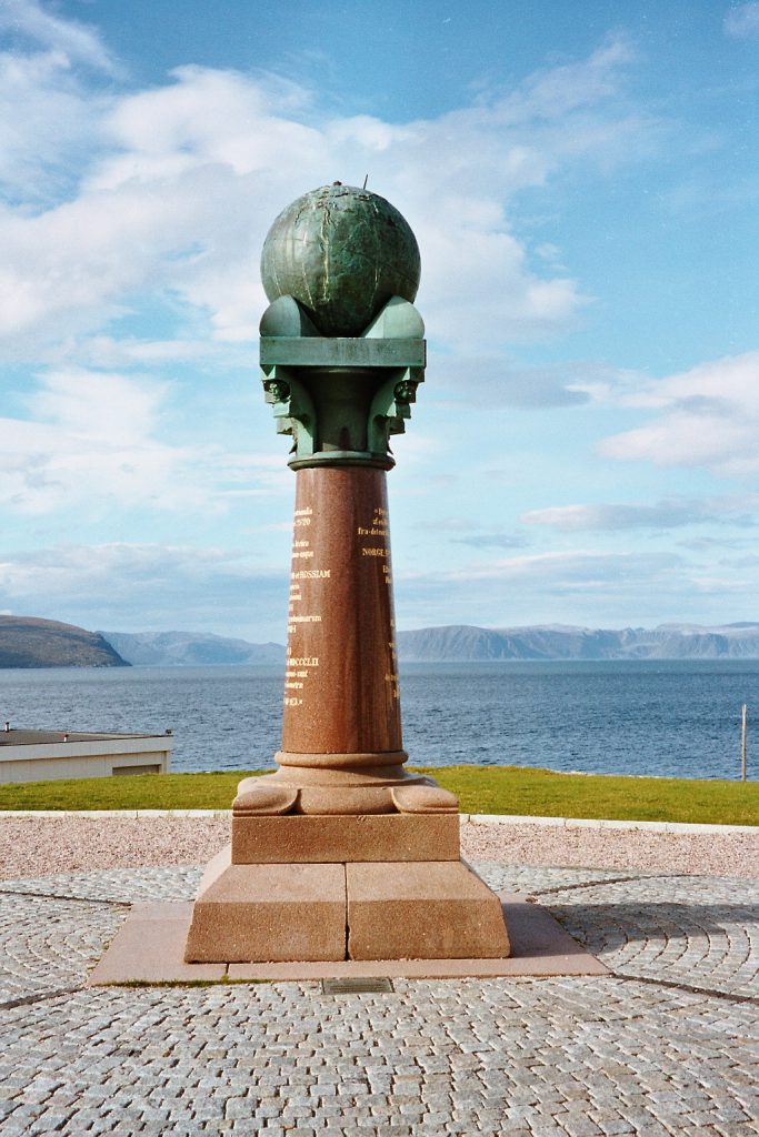
The Struve Geodetic Arc stands as a monumental achievement in the annals of scientific history, representing the culmination of decades of meticulous surveying and collaboration. Stretching over 2,820 kilometers from Hammerfest in Norway to the Black Sea, this extraordinary chain of triangulations was meticulously measured between 1816 and 1855 under the leadership of astronomer Friedrich Georg Wilhelm Struve. This article delves into the significance of the Struve Geodetic Arc, exploring its historical context, scientific contributions, and enduring legacy.
Tracing the Origins: Scientific Endeavor and Collaboration
The quest to accurately measure the Earth’s size and shape dates back centuries, with early attempts relying on rudimentary methods and limited technological capabilities. However, the advent of triangulation in the 16th century revolutionized surveying techniques, paving the way for more precise measurements. Building on this foundation, Friedrich Struve and his team embarked on an ambitious mission to measure a long segment of a meridian, spanning across multiple countries and terrains. The resulting arc not only provided invaluable insights into the Earth’s dimensions but also fostered unprecedented scientific collaboration among nations and monarchs.
Architectural Marvels: Marking the Points of Measurement
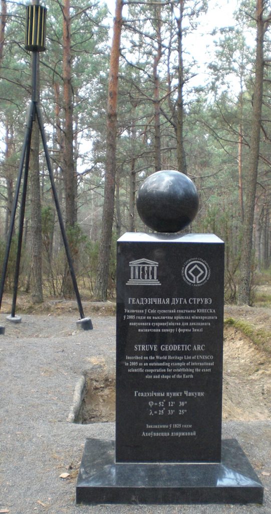
The Struve Geodetic Arc comprises 34 meticulously surveyed points, each marked with distinctive symbols, including drilled holes, engraved crosses, and commemorative monuments. These markers, scattered across ten countries, serve as tangible reminders of the monumental scientific endeavor that took place over a century ago. Despite the passage of time, these points retain their authenticity and significance, offering a glimpse into the technological prowess and collaborative spirit of the era.

UNESCO Recognition: Celebrating Scientific Achievement
In 2005, the Struve Geodetic Arc was inscribed as a UNESCO World Heritage Site, recognizing its outstanding universal value and contributions to the field of earth sciences. Meeting criteria related to scientific collaboration, technological innovation, and cultural significance, the Arc stands as a testament to human ingenuity and curiosity. Its inclusion on the World Heritage List serves as a tribute to the tireless efforts of the scientists and surveyors who contributed to its creation.
Preserving Integrity and Authenticity
Ensuring the integrity and authenticity of the Struve Geodetic Arc is paramount to safeguarding its cultural and scientific significance for future generations. With each component meticulously preserved in its original location, efforts are underway to protect and manage these historic landmarks. National authorities, in collaboration with international coordinating committees, oversee the conservation and management of the Arc, ensuring that its legacy endures for centuries to come.

Looking to the Future: Promoting Awareness and Collaboration
As custodians of this invaluable heritage, it is incumbent upon all stakeholders to promote awareness and collaboration in the preservation of the Struve Geodetic Arc. Through educational initiatives, exhibitions, and commemorative projects, the Arc’s rich history and scientific significance can be shared with audiences around the world. By fostering international cooperation and stewardship, we can ensure that the legacy of the Struve Geodetic Arc continues to inspire and educate future generations.
Conclusion: A Monument to Human Ingenuity and Collaboration
In conclusion, the Struve Geodetic Arc stands as a testament to the power of human ingenuity, collaboration, and scientific endeavor. From its humble beginnings as a surveying project to its recognition as a UNESCO World Heritage Site, the Arc embodies the spirit of exploration and discovery. As we celebrate its legacy, let us also reaffirm our commitment to preserving and promoting the rich heritage of the Struve Geodetic Arc for generations to come.
Read in Rachona: Unveiling the Legacy of the Struve Geodetic Arc


